



TerraByte
Search authoritative GIS layers, look up places and nearby facilities, and map the results and recent satellite imagery in Claude.
 View in the Claude registry
- Brand
- TerraByte AI
- Category
- Data & Analytics
- Primary Subcategory
- Geospatial & Spatial Analytics Data
Integration details
Description
TerraByte makes authoritative geospatial data searchable from Claude. Ask a location question in plain language and TerraByte finds the official data layer that answers it, pulls the live features, and shows the result on a map. Search GIS layers: semantic search layers from flood and other hazard zones, power lines, pipelines, ports, railroads, schools, hydrography, protected areas, demographics and climate. Inspect a layer's fields and query its features for any area. Look up places: resolve an address or place name to a point with its precision, and find nearby hospitals, schools, fire stations and other facilities with distance and direction. Draw maps: show the analysis as an interactive map with pins, buffers, lines, polygons and real layer geometry, on a basemap or overlayed on dated satellite imagery. Every layer result includes its source, coverage, data date and license, so answers can be checked and cited. Requires a TerraByte account; usage counts against your TerraByte plan.
- Integration type
- Connector
- Verification status
 Community connector
- Platform
- Claude
- Primary Subcategory
- Geospatial & Spatial Analytics Data
- Secondary Subcategories
- None listed
- Brand
- TerraByte AI
- Access
- Account required
- First tracked
- 2026-09-17
- Tool count
- 3
- Market
- US
The Primary Subcategory used for this profile’s headline score.
Other Subcategories where the Integration is listed.
 Agent DiscoverabilityClaude Discoverability Score
Claude Connector discovery is coming soon
Community Connectors only appear in Claude’s registry.Once verified, organic discovery begins and we can calculate your score.Read more about Community Connector verification.
No spam. Unsubscribe any time.
What discovery looks like
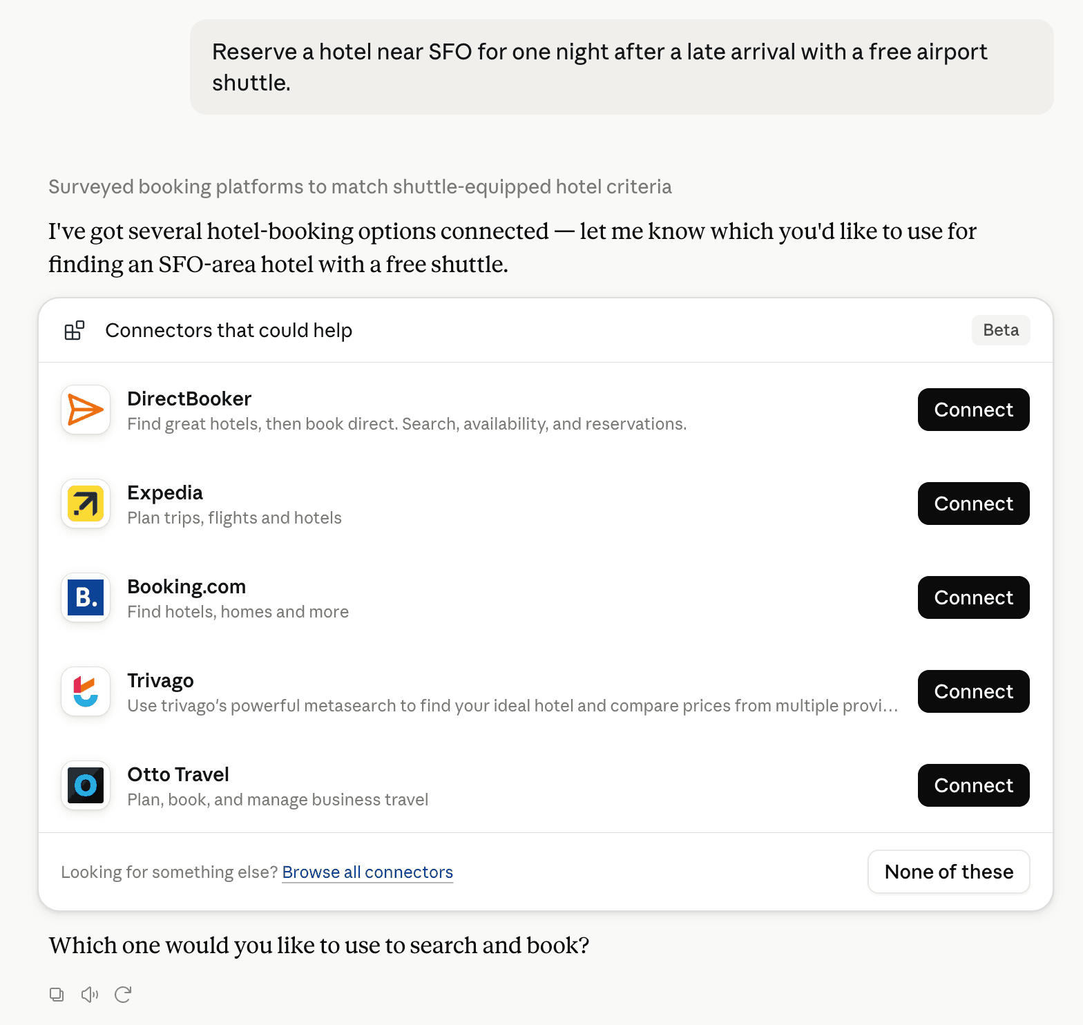
Claude can surface verified Connectors when they match a user’s Prompt.
How Claude Connector discovery works
Your Connector will compete to appear for users’ Prompts once Claude verifies it
Competing in Claude Geospatial & Spatial Analytics Data
View Category3 tools agents can invoke

TerraByte Claude Connector FAQ
How the directory, categories and Discoverability Score work.
Read the methodologyHow do I improve TerraByte's Claude Connector discoverability?
The levers are the listing surface agents actually read: names, descriptions, keywords, tool metadata, and registry health. Which lever matters depends on where discovery breaks, which is what continuous measurement shows.
What are TerraByte alternatives on Claude?
As of 2026-11-07, TerraByte competes with Alloy Robotics, Aviation MCP, barocline, BigGeo AI, Biohotspot, Birdi, CDXGeoStream, ExplorationMaps and 41 more in Claude Geospatial & Spatial Analytics Data, ranked by public Discoverability Score.
Where is this profile measured?
This profile uses the geography attached to the latest public registry snapshot: US. Locale tags are intentionally omitted.